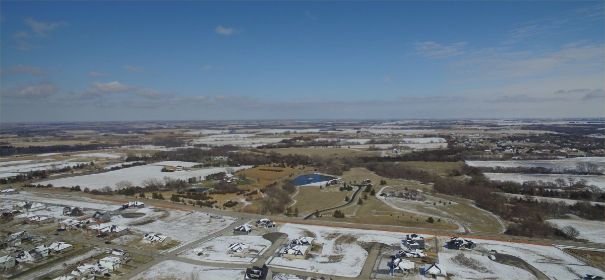
April 1, 2018: Lincoln received an April Fools joke with a morning snowfall that rapidly
melted away in the afternoon spring sunshine.
Related Links:
Last Month's Data, March 2018
Lincoln's Cold Weather Climatology
Climate News
Lincoln's snowfall climatology
Year 2018 (and last year) Precipitation in inches compared to normal
|
Normal
|
0.64
|
0.77
|
1.93
|
2.71
|
4.29 |
4.34
|
3.40
|
3.49
|
3.02
|
1.97
|
1.43 | 0.95 |
28.95
|
|
2018
|
0.41
|
0.74
|
2.71
|
0.67
|
4.53
|
||||||||
|
2017
|
1.10
|
0.55
|
1.62
|
3.55
|
6.29
|
7.35
|
5.99
|
3.38
|
1.85
|
4.90
|
0.07 | 0.38 |
37.03
|
Normal January 1 - March 31 Precipitation total = 3.34 inches
Normal January 1 - April 30 Precipitation total = 6.05 inches
Winter 2017-18 (and last year) Snowfall (in inches) compared to normal
|
Normal
|
0.7
|
2.1
|
5.9
|
5.4
|
5.6
|
4.8
|
1.4
|
0.0
|
25.9
|
|
2017-18
|
T
|
0.0
|
4.3
|
3.4
|
10.0
|
0.7
|
3.0
|
.
|
21.4
|
|
2016-17
|
0.0
|
T
|
1.7
|
3.2
|
2.0
|
0.6
|
0.0
|
0.0
|
7.5
|
T = a Trace. Snowfall was observed but not enough to be measured
RECORD cold daily low temperature of 10°F on April 7. Old record 16°F set in 1936
RECORD cold daily high temperature of 33°F on April 15. Old record 41°F set in 1945, 1917
All data in the following table are from the National Weather Service and HPRCC data archives.
If columns are hidden, scroll the table right.
|
April
| Pcpn | Max | Min | Max | Avg Min | Avg Mean | Snow | ||||||||
|---|---|---|---|---|---|---|---|---|---|---|---|---|---|---|---|
|
Sunday
|
Apr. 1
|
33
|
19
|
26
|
-20
|
0.08
|
39
|
0
|
59
|
33
|
46
|
0.8
|
|||
|
Monday
|
Apr. 2
|
33
|
18
|
26
|
-21
|
T
|
39
|
0
|
60
|
34
|
47
|
T
|
|||
|
Tuesday
|
Apr. 3
|
39
|
19
|
29
|
-18
|
T
|
36
|
0
|
60
|
34
|
47
|
T
|
|||
|
Wednesday
|
Apr. 4
|
48
|
14
|
31
|
-16
|
0.00
|
34
|
0
|
60
|
34
|
47
|
.
|
|||
|
Thursday
|
Apr. 5
|
65
|
25
|
45
|
-3
|
0.00
|
20
|
0
|
61
|
35
|
48
|
.
|
|||
|
Friday
|
Apr. 6
|
40
|
16
|
28
|
-20
|
0.01
|
37
|
0
|
61
|
35
|
48
|
0.2
|
|||
|
Saturday
|
Apr. 7
|
42
|
10
|
26
|
-22
|
0.00
|
39
|
0
|
61
|
35
|
48
|
.
|
|||
|
Sunday
|
Apr. 8
|
48
|
29
|
39
|
-10
|
0.00
|
26
|
0
|
62
|
36
|
49
|
.
|
|||
|
Monday
|
Apr. 9
|
40
|
24
|
32
|
-17
|
0.00
|
33
|
0
|
62
|
36
|
49
|
.
|
|||
|
Tuesday
|
Apr. 10
|
68
|
21
|
45
|
-5
|
0.00
|
20
|
0
|
63
|
37
|
50
|
.
|
|||
|
Wednesday
|
Apr. 11
|
77
|
39
|
58
|
+8
|
0.00
|
7
|
0
|
63
|
37
|
50
|
.
|
|||
|
Thursday
|
Apr. 12
|
73
|
38
|
56
|
+6
|
0.00
|
9
|
0
|
63
|
37
|
50
|
.
|
|||
|
Friday
|
Apr. 13
|
82
|
45
|
64
|
+13
|
0.00
|
1
|
0
|
64
|
38
|
51
|
.
|
|||
|
Saturday
|
Apr. 14
|
49
|
25
|
37
|
-14
|
0.43
|
28
|
0
|
64
|
38
|
51
|
1.8
|
|||
|
Sunday
|
Apr. 15
|
33
|
23
|
28
|
-23
|
0.01
|
37
|
0
|
64
|
39
|
51
|
0.2
|
|||
|
Monday
|
Apr. 16
|
51
|
27
|
39
|
-13
|
0.00
|
26
|
0
|
65
|
39
|
52
|
.
|
|||
|
Tuesday
|
Apr. 17
|
60
|
29
|
45
|
-7
|
0.00
|
20
|
0
|
65
|
39
|
52
|
.
|
|||
|
Wednesday
|
Apr. 18
|
47
|
34
|
41
|
-11
|
T
|
24
|
0
|
65
|
40
|
52
|
T
|
|||
|
Thursday
|
Apr. 19
|
60
|
24
|
42
|
-11
|
0.00
|
23
|
0
|
66
|
40
|
53
|
.
|
|||
|
Friday
|
Apr. 20
|
63
|
31
|
47
|
-6
|
0.00
|
18
|
0
|
66
|
41
|
53
|
.
|
|||
|
Saturday
|
Apr. 21
|
53
|
44
|
49
|
-5
|
0.01
|
16
|
0
|
66
|
41
|
54
|
.
|
|||
|
Sunday
|
Apr. 22
|
68
|
34
|
51
|
-3
|
0.00
|
14
|
0
|
67
|
41
|
54
|
.
|
|||
|
Monday
|
Apr. 23
|
75
|
34
|
55
|
+1
|
0.00
|
10
|
0
|
67
|
42
|
54
|
.
|
|||
|
Tuesday
|
Apr. 24
|
73
|
36
|
55
|
0
|
0.07
|
10
|
0
|
67
|
42
|
55
|
.
|
|||
|
Wednesday
|
Apr. 25
|
59
|
38
|
49
|
-6
|
0.06
|
16
|
0
|
68
|
43
|
55
|
.
|
|||
|
Thursday
|
Apr. 26
|
71
|
34
|
53
|
-2
|
0.00
|
12
|
0
|
68
|
43
|
55
|
.
|
|||
|
Friday
|
Apr. 27
|
81
|
31
|
56
|
0
|
0.00
|
9
|
0
|
68
|
43
|
56
|
.
|
|||
|
Saturday
|
Apr. 28
|
68
|
32
|
50
|
-6
|
0.00
|
15
|
0
|
69
|
44
|
56
|
.
|
|||
|
Sunday
|
Apr. 29
|
77
|
49
|
63
|
+7
|
T
|
27
|
2
|
0
|
69
|
44
|
56
|
.
|
||
|
Monday
|
Apr. 30
|
85
|
61
|
73
|
+16
|
0.00
|
0
|
8
|
69
|
45
|
57
|
.
|
|||
|
April
|
Max | Min | Mean | Dep | Pcpn | Rec Pcpn |
Rec Max |
Rec Min |
HDD | CDD | Avg Max |
Avg Min |
Avg Mean |
Snow | |
|
|
TOTAL
|
|
0.67
|
|
|
|
.
|
.
|
|
|
|
3.0
|
|||
|
|
AVERAGE
|
58.7
|
30.1
|
44.4
|
|
|
|
|
|
|
|
|
|
|
|
|
NORMAL
|
64.3
|
38.8
|
51.6
|
|
2.71
|
|
|
416
|
13
|
|
|
|
1.4
|
||
|
DEPARTURE
|
-5.6
|
-8.7
|
-7.2
|
-2.04
|
|
.
|
|
+1.6 |
AVERAGE AND TOTAL are APRIL 2018.
Temperature is °F
Precipitation measurement is "inches"
Precipitation "T" = trace, precipitation was observed but not enough to be measured
NORMAL (Norm) refers to the 1981-2010 Standard Normals
DEPARTURE is APRIL 2018 Average measured against 1981-2010 normals, °F.
Max = Observed Maximum and Min = Observed Minimum temperatures in °F.
Mean = Observed Mean Daily temperature in °F.
Dep = Departure from normal ( __ = below normal, + above normal), in °F.
Pcpn = Observed daily precipitation (midnight to midnight, CST) in inches.
Rec Pcpn = Record daily amount of precipitation in inches.
Rec Max = Record maximum temperature in °F.
Rec Min = Record Minimum temperature in °F.
HDD = heating degree day units (base of 65 degrees) in °F.
CDD = cooling degree day units (base of 65 degrees) in °F.
Norm Max = Daily Normal High Temperature (1981-2010 normals) in °F.
Norm Min = Daily Normal Low Temperature (1981-2010 normals) in °F.
Norm Mean = Daily Normal Mean Temperature (1981-2010 normals) in °F.
Snow = Snowfall in inches.
From the record books:
Warmest recorded APRIL temperature, 97°F, April 26, 1989; April 28, 1910.
Coldest recorded APRIL temperature, 3°F, April 3, 1975.
SNOWFALL: 119 Years (1900 - 2018)
Most APRIL Snowfall: 11.1 inches, 1997.
In the last 119 years, 1900 - 2018, April had measurable snowfall 55 times (46% of the years)
In the last 119 years, 1900 - 2018, April had no measurable snowfall 64 times (54% of the years)
A Trace (T) of snowfall means snowfall was observed but not enough to measure, i.e. it is not measurable.
NOTE: All data on this page are from the National Weather Service and HPRCC data archives.