Vegetation Drought Response Index (VegDRI)
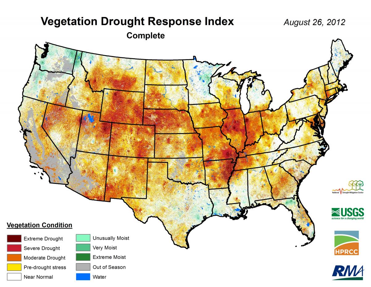
Image: 1-km VegDRI map showing the severe to extreme drought conditions that persisted across most of the central U.S. during the summer of 2012.
VegDRI is a composite drought indicator combining satellite-based observations of vegetation conditions, climate-based drought index data and several environmental landscape characteristics (e.g., soils, elevation and land use/land cover) to characterize seasonal-scale, drought-related vegetation stress. Production of VegDRI at 1-km spatial resolution across the continental U.S. has been operational since 2008 and is routinely used by U.S. Drought Monitor (USDM), National Weather Service, Bureau of Land Management and various state-level drought task forces. More information about QuickDRI can be accessed on the VegDRI website: http://vegdri.unl.edu/.
Research is ongoing with researchers at Agriculture and Agri-Food Canada to extend the VegDRI approach to Canada for agricultural drought monitoring purposes. Training and research on VegDRI-like approaches have also been conducted with scientists from the Czech Republic, India and Mexico.
Center Faculty: Wardlow
Collaborators: